Sunday, December 11, 2011

HAWAII: SIgning Off

Before I delve into the many attributes of Hawaii, I must not like to forget the region's commonalities with The Dalles (Oregon State). I found two: volcanism and agriculture.

Mount Hood, dormant and peaceful
VOLCANISM
Kilauea - in full blown effect!
Mount Hood, located very close to The Dalles, is a stratovolcano which eruptional history is evidence of the Pleistocene epoch. It is inactive, dormant since the late Pleistocene, unlike Hawaii's various volcanoes which are all active.


High Mountain Peaks
In the PNW, Mount Rainier is at 14,000+ ft in elevation. Also a stratovolcano. Mauna Kea, at 13,000+ ft in elevation is an active volcano. By feet, it comes close by just about a thousand feet. Another difference is one is an active volcano, while another is completely dormant.


Hawaii's agriculture has varied in strength in the past few years (since WW2). Its traditional crop, pineapple, has declined in income since. Once providing 16.5% of the state's income, it dwindled to 2% by 1985. Sugar was from 20% to 4%. If it wasn't for such a decline, I'd say that Hawaii and The Dalles could still make a good fruit salad.

Land Ownership
Half of Hawaii is government-owned, much like various parts of the West and PNW (Alaska specifically). 80% is controlled by the federal government. The small amount of private landowners are then at stake. They must lease the land, and once lease is up, they must renew it at a higher rate. Urban development is in high demand, and it becomes a vicious cycle of raising cost of living. I believe this would be something the people of PNW ultimately fear: overcrowding and high demand to develop urban setting. It is the ultimate worst-case scenario for the PNW-ers who are living in peace.

IT'S HERE: THE PACIFIC NORTH COAST BLOG

I'm very excited to finally  be able to write about the Pacific NorthWest. So excited, I don't even know where to start.
pine trees and tundra, yay!


Labeled "ecotopia", cities around the Pacific North West are considered the "most livable" and attractive cities in North America (Portland and Seattle). Landscapes are beautiful and bountiful. The pristine status of states like Oregon and Washington bring concern to residents: the fear that overpopulation will ensue, disturbing their peaceful living settings. There is an advantage to this concern: its location is quite remote, as it is at the northwestern corner of the region. There are accessibility barriers, no public transport that can commute the rest of the west coast to the area. Arid and mountainous terrain works as a topographic barrier as well.

My blog layout is highly influenced by the precipitation levels in Oregon state. Precipitation is abundant, which provide trees, moss, ferns, rich soil for agriculture. Its likely that there is more weight of living matter in this part of the earth than any other place. I'm so proud to have chosen this area for my assignment :) Precipitation patterns vary in different parts of the region according to topography: wind patterns, ocean, and mountains all play role in temperature and precipitation. Oregon state, in particular, experiences high winds.

Oregon (along with Washington) contain coast ranges, much like that of California state.

Grand Coulee Dam - Columbia River

The Dalles, the city in which I am centering this blog around, is called The End of the Oregon Trail.  The textbook acknowledges The Dalles as being the city in between both Oregon and Washington. It was labeled "the end' of the Oregon Trail by explorers Lewis And Clark. According to the text, Lewis And Clark explored this area and ran into dangerous falls. Precipitation and rugged terrain make up for a great resource for hydroelectric power. In 1933 the Grand Coulee Dam was constructed on the Columbia River. It remains the regions largest dam. I remember visiting this dam the first few weeks I was in The Dalles as a child.


Fishing is one of the strongest resources of the PNW. Salmon was once a major food and economic source for the Native tribes, and it kind of still is post-European settlement (present day).They're anadromous, which means they travel upstream to spawn seasonally in the freshwaters of the rivers. They were once very abundant in the rivers as fishers had great chances of catching many a salmon. But salmon was more often caught off the ocean, making the salmon population smaller during their spawning return.


AGRICULTURE
I'll start off with The Dalles to emphasize their agriculture. The Dalles grows cherries and peaches in the region. While it grows a vast amount, there are export barriers that does not allow it to be shipped to other parts of the United State easily. Instead, crop goods stay within the region, providing to the local. North of The Dalles grows apples and pears, primarily in Washington state. The proximity of these fruits makes me think that the region makes for a perfect fruit salad.

Hops, grass, and spearmint are other crops that thrive around Oregon state. As a matter of fact, I have a memory of driving up there with my family, stopping at a mint field, and a relative picks out a leaf from field and said it was okay to chew. It was spearmint. It was the first time I'd ever try a mint leaf :)
 While the above mentioned crops is abundantly grown in the region, it is actually dairy that's the cash cow of the region.


Next dairy comes forest products. Timber comes from all the states that make up the PNW, Canada included. Douglas fir, spruce, hemlock, balsam, and red cedar are types of wood abundant and demanded. The red cedar is abundant in Oregon state. Its big, red, and beautiful! The demand for lumber runs high, especially in Japan, its largest importer.


While I never saw a beaver, I thought I'd throw in the mascot of every dam in the United States. I salute you, Beaver state!!!
hi cutie

Another look at the Empty Interior & California - Oregon Territory

Arid climate area in Oregon State - similar to that of California
During my Empty Interior blog entry, I definitely went to town on its land beauty and controversies, but I feel I did not cover the influence in Oregon state. As I've repeatedly mentioned during my entries, The Dalles is like a geographic cusps as I've noticed while learning about US & Canadian regions.

In turn, I've decided to give Oregon state its respects to the Empty Interior.

Central Oregon makes up the Empty Interior. The Columbia River shares the Empty Interior to the east, and the Pacific North Coast to the west. In my earlier blog posts, I previously mentioned that the eastern part of Wasco County is made up of arid climate and shrub-like vegetation, much like California's meditteranean climate. I suppose this goes for Oregon's similarities to California: a fair section of Oregon shares this type of climate.

California - Getting REALLY CLOSE to the PNW!

As we get closer to covering the rest of US geography, we approach a very unique region in Chapter 15 of the textbook. It is the California region, covered by only one state: California.

Klamath - visibly transitional 
Unlike the other regions we have yet covered, there are absolutely NO transitional areas that surround California. The region is contained right within its state boundaries, with the exception a small section folding over the corner of Nevada. The state is full of different forms of diversity. It is home to 12% of Americans. Its national image stands as the state alone.  When it comes to any sign of transition, I would consider the Klamath Mountains to kind of being a unofficial transitional area between California and Oregon.

The following descriptions will be full of illustrations (thanks to the textbook) that tell us all about California. 

Diverse, diverse, and more diverse. Let's start off with the physical geography of California.
The coast ranges are an array of long, linear mountain ranges that run northwest to southeast, along the coast.  Its topography is linear due to the land movement along the fault zones, which are parallel to the coast. The Central Valley runs 400 miles north-south, 95 miles wide (east west). It provides a huge amount of agriculture for the state alone and other surrounding states. Its fertile soils and great climate make for one of the best places for agriculture. East of the Central Valley is Sierra Nevada, which is the edge of Nevada state, made up of "fault block" mountains, there are major barriers to movement, which is pretty much the opposite of the western coast of the area where the San Andreas fault lies.
Coast ranges make up alot of California, and there indeed a fair share of coast ranges among Oregon state (leading to The Dalles). 

Speaking of faults, it is known for its various fault zones where earthquakes are somewhat frequent and have changed the state's topography in the past. 

Owens River waterbed, almost dried out by Los Angeles.
Water - with agriculture dominating so much of California, water demand runs high. And with the 12% of American inhabiting the state, water demands adds even higher. About 8.5 million acres of land is irrigated in the State of California. Water projects have cost millions in dollars and resource. Groundwater was dried out in Los Angeles, which resulted in creating aqueducts from regions like the Owen Valley. LA's demand for water due to urbanization ended up drying the Owen's River.


There is also a sort of "water mismatch" situation happening in California. There is high precipitation levels in Northern California, and while they are low in Southern California, the demand for water is higher. The long stretch between the north and south regions of the state make it hard for water development projects.

Great Climate, and yet more diversity in the climate area within the state. Desert, interior and coastal semi-arid, dry, mild and hot Mediterranean....desert, semi arid alone, dry summer, and alpine. A total of 10 different climate types rule one single state.

The automobile industry has impacted California strongly. The disadvantage of the state is that there are topographic barriers towards the east. Since the state is very large, and provides many highways to get from one point to another, automobiles are vital to California citizens. Public transportation is scarce, except in San Francisco. Due to so much travel via automobile, smog levels tend to be higher in the state than in any other region in the US. Efforts to reduce smog levels in the air are strongly enforced by creating vehicles with lower emissions and setting high standards for things like smog checks.

North of California is shared with transitional areas of the PNW (but not vice versa). High levels of precipitation  towards Northern California are shared along with Oregon State (Portland, Wasco County). Small areas of alpine is similar to that of the PNW. The agricultural aspect of the state is shared with that of Wasco County. East of Wasco County is also made up of arid-semi arid climate.


The following will be images of different parts of California for the sake of landscape diversity as well :).
 
Vineyards in Central Valley
Eastern Sierras, picture from yours truly! 

San Francisco, CA - urbanized in Northern California.
Los Angeles, downtown area. Largest city in Southern California.

Mojave Desert (Joshua Tree National Park)

Humboldt, CA (NorthWest) - starting to look more like the PNW, no?


San Francisco is one of the most important port cities on the west coast. Water barriers centers the city. It is ethnically diverse, neighborhoods being much like ones in New York (Little Japan, Little Italy, Chinatown, et cetera). Terrain is not so flat, and the BART (Bay Area Rapid Transit) transportation system is one of the best in the states.

The South West Border - Below The PNW, Big in Diveristy


The theme to Chapter 14's Southwest Border seems to be population, so I shall center into this human geography theme. 

The Southwest Border is the cusp between south of North America and Mexico, our neighboring country.  East to west, it dips into Texas, covers most of New Mexico, Arizona, southern California, and slightly bumping into Colorado. The transitional areas are above, and while it may not be marked on the map above, the transitional area varies more going into Mexico. But since this material covers US & Canada, transitional areas going south does not quite pertain.

Hopi housing reservation.

From the previous blog, the Southwest overlaps into the Empty Interior a bit (within the Four Corners). The Empty Interior's arid to semi-arid climate is shared by the Southwest. During years of settlement, the Anglos were discouraged from its aridity, since it did not provide lush vegetation or agriculture. As a result, there were a substantial number of Native Americans in this region. Was it due to the fact that most Native American tribes got to stay, or was it because tribes from other US regions migrated there because invasion wasn't active in the Southwest? #humangeographerquestion.

map of Native American Reservations, present day.
In present day, that aridity has attracted Anglos, particularly those who are retiring. Also, the Southwest is considered a tri-cultural region: Latinos (25%), Anglos (74% WOW), and Native Americans (just 1% now) make up the tricultural population.


While it lasted, the Native Americans were the most culturally diverse of the three. The groups were Navaho, Pueblo, Papago, Hopi and Utes. The Hopi, being one of the largest, shares a huge chunk their reservations within the Four Corners. Around the Hopi are scattered reservation of the rest of the tribes.

Mexico more than strongly influenced the Southwest border. During the 1800's, The Mexican War begun a fight between Texas (US) and Mexican territory when Texas was annexed in 1845. After the secession, the Mexican population was low, but not for long. Immigration from the lowest Mexican populations increased dramatically during the 20th century. Territory may have officially been removed from Mexican ownership, but it did not stop the people from claiming the land in other ways. The proximity of the two countries promotes lots of "point of entry" migration, south to north.

Many push factors in the Southwest region for the rise in Mexican population during the 20th century. The proximity and ease of border-crossing allowed for geographic accessibility. Due to economic growth in the US, job availability was high. In present day, the pull factors became almost the opposite of its original push factors: the Mexican population became widespread, and the unemployment rate spread right with it. U.S. Border Patrol is enforcing entry stronger than ever. Current Mexican Drug War is another possible push factor.  

Maquiladoras in Mexico
Maquiladoras & NAFTA - CROSS BORDER ECONOMY
A pull and economic factor of the Southwest. Maquiladoras were initiated in the 1960's as "coupon houses". They are assembly plants that import duty-free components and raw materials. The finished goods are then exported to US. In 2000, it was recorded that there are 4,000 maquiladoras between Mexico and Tijuana, 1.2 million employees.


NAFTA took into effect in 1994. It was an established trade agreement between Mexico, Canada, and the US in which there was a reduction and regulation of trade tarrifs, barriers, and quotas between all three members. It helped standardize the financial and service exchanges between the three. As a result, it created jobs for Mexicans as US companies, which encouraged the US to invest more in the Mexican market. Mexican exporters increased their sales to both US & Canada.


Not a lot of commonalities between the Southwest and Northwest. Well, they're BOTH west. There is a Latino population in parts of the Pacific NorthWest. In present day, according to the US Census, there is 14% Hispanic Population in Wasco County. This explains perhaps a spreading of the Latino population that stems from the Southwest point-of-entry border. For a fact, I have many relatives whom are of Mexican descent who started off in Los Angeles, and kept moving north until they settled in Wasco County and surrounding. Many found jobs in the agricultural sector.

Saturday, December 10, 2011

Plains & Prairies - PNW Can Relate On A Small Scale

Chapter 12 in the Geography of  U.S & Canada textbook covers the Plains And Prairies, a huge chunk that covers the middle of the United States. When settlers discovered it, it had critical acclaim:

"This region is the best I've seen for producing the crops of Spain. The land is very flat and black...well watered by the rivulets and springs and river," said Francisco Vasquez de Coronado.

"The Great American Desert", 1850 United States nicknamed it.

"Wholly unfit for  cultivation and habitat.", said the East Coasters of the 1800's.

In this chapter we shall learn why it can grow Spanish crops, why it was nicknamed the Great American Desert, and why East Coasters thought it was unfit. 

For starters, the physical geography of the plains and prairies has a huge elevational range (covering such a large part of the US, its bound to). East to west, it starts off at 1,600 feet and transitions to 5,000 feet. The Southern half though, shares more of unvaried range of elevation. There are two subdivisions of this entire region: the High Plains from Texas to Southern Nebraska (Edward Plateaus) and the Lake Agassiz Basin (Pleistocene lake evidence) covering the northern part of the Plains & Prairies, which crosses over to Canada.

A nice slice of the US dominated by prairies and plains. Check it out, not too shabby!
Along with elevational variation, there is topographical. The Great Plains has its share of hills and what's considered "badlands". These hills include Black Hills (part of the Rocky Mountains), Cypress Hills (Canada), and Sand Hills (central and NW Nebraska). The badlands are irregular, topographic land stemming from erosion. While it may sound non lucrative or scenic-landscape-material, two national parks that honor the badland topography: Badland National Park (South Dakota) & Theodore Roosevelt National Park (N. Dakota).


Now, for curiosity sake, I shall google and search what these parks look like....
Badlands National Park in S. Dakota, not too bad....

Referring back to what the East Coasters said in the 1800's, maybe this is what they meant when they were talking about unsuitability for cultivation...because the next section I will be talking about is the grand amount of vegetation the Great Plains has been known to be suitable for.


The Great Plains are widely known for its vegetation. Grasses is what make up the Prairie landscape. Taller and denser on the eastern part of the region, shorter and dispersed as you head west. The grass patterns are most likely in due to climate patterns. In the US region, precipitation stems from the conflict of air masses, particularly the cool, dry air from the north and the warm moist air from the Gulf of Mexico. The two intertwine together creating a wet environment that helps the grasses grow. In the Canadian region, the climate pattern is independently NE to SW. With that said, there is a wide variation from to year-to-year average. It ranges anywhere from 80% to 120% in precipitation! Huge numbers, huge variation. The lowest percentage of precipitation average is during the month of April, which is still a hefty 75%. These April showers are nothing compared to the rest of the year. 

In the US region, the mix of two air mass systems tends to create extreme weather, thunderstorms. Producing heavy rain, wind, and lightning.

Now, how does this relate to the PNW?
This chapter was very interesting to me, since I knew little of the Prairies (so as I was writing about it, of course I got sidetracked). But as I read about it, there are various similarities. Frequency of rain is also common in the PNW. While the Great Plains has a huge share of natural resources and vegetation, so does Oregon state, but of course at a smaller scale. Large natural landscape is available in both regions, but of course at a smaller scale for the PNW. Also, the fact that both regions share US AND CANADIAN soil.
 

How do they not relate?
While they are various uncommonalities between each region, one of the variables that highly stood out for me was the lack of trees in the Great Plains. The PNW is known for its deciduous forest and dendra, while The Great Planes & Prairies is known for its grasslands. Both regions are examples of lush and green natural resource, but of course, they differ in different shades of green. Check below for the difference!

 
Great Plains
Pacific Northwestern National Park

Empty Interior - RICH in Beauty!

For years Oregon state was the apple of my eye, since I hung out there during my early years. That might change when I visit/travel this part of the states. I'm truly intrigued by its rich geography and geology!

Chapter 13 is all about the Empty Interior. And it looks the "interior" covers a few bases around the west and even the Pacific NorthWest.  I see that it slightly touched Portland and Wasco County as the transitional period. Does this mean that these chapter might FINALLY be getting closer to covering PNW material? I sure hope so!

It covers New Mexico, Arizona, Nevada, Utah, most of Colorado, Idaho, half of Wyoming, a piece of California, and HALF of Oregon!

I digress. The interior is rests on the Coloroado and Columbia Plateau. The Colorado Plateaus is along the middle of the Colorado River in Utah & Arizona, main parts of the interior. They are gently touching into sedentary rocks, and the major landscapes are due to features from erosion by something called exotic rivers. This is more apparent in Colorado. The Columbia Plateau nests towards the Pacific North West. It formed due to lava flow build up as deep as 2000 feet!

I think we are finally getting closer to my US site of choice....

Bryce Canyons National Park, part of the Public Land/Conservation Programs.

Another popular term I've previously heard that describes the Empty Interior is Basin & Range. It covers across South New Mexico, Arizona, west of Death Valley, and Mojave Desert. Within this region, there's about 80 flat basins containing quite a few ridges (200!). With all of its geologic beauty, it comes with a price: no drainage outlet to the sea, which brings me to  delve into geomorphic processes curiosity.

Lets move on to CLIMATE. For the most part, the Interior is arid to semiarid, specifically in the Southern section. It covers most of North America's desert area (sharing with the Southwest). It shares its extremes: the low lying areas tend to be dry, while there is a share of heavy precipitation on the mid-slopes of mountains.

There seems to be some controversy with Public Land ownership in the Interior. The area is under government control, 90% of Nevada is public land. Now the question is, which sliver of Nevada ISN'T public land? Curiosity isn't killing, but its surely deterring me. Well, judging from the map, it looks like the majority of the Interior is federally-owned one way or another. They are subdivided into categories such as Conservation programs (like national parks, national forests, and Canadian provincial land areas). There is also areas where Indian Reservations dominate the land. It is often criticized due to the stifling of further planning.

While I can understand where the criticism is coming from, I'm a firm believer that such freedoms to use the land are hindered for a reason. When it comes to the preservation of land, I feel that any prevention of planning is more than acceptable. The landscapes of erosion and endless miles of arid desert land are like U.S. pieces of natural art. The tourism generates a fair amount of money into the region. Urbanizing it would pretty much destroy the delicate basins that puzzle the area. Conservation programs are a great way to protect the land. Federal ownership of land, in my opinion, is not too shabby.

Canyon Lands National Park.
Wouldn't want to see a hint of urbanization
anywhere near these folds of sedentary rocks.


I'm happy that this chapter is getting closer to the PNW...In any case, I feel that their similarities contrast a bit but there's a piece of commonality. The Interior has lands that are considered National Parks, as does Oregon State and the surrounding PNW. The Interior depends on these "erosional beauties" in order to attract tourism, awareness, and its an excellent way to preserve the land for what it is. The PNW has its share of National Parks in order to preserve dendra, canopy beds, and wildlife.


American bison
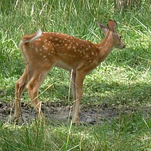
Speaking of WILDLIFE....The Interior is home to the bison, elk, pronghorn antelope, and the white-tail deer. A positive correlation to the public land ownership could be that the animals rose in population in the 1930's, somethings that's pretty much unheard of since native species tend to decline in population so often. Now not all species are blooming in population: there has been an unfortunate
decline in the wolves species due to its re-introduction from being in the endangered species list. Once it was re-introduced, it attracted hunters.

Proghorn Antelope with heart shaped antlers.

Mexican gray wolf. Please stop hurting this guy, hunters.

Thursday, December 8, 2011

Range Survey System - The Core's Systematic Method

This entry is a continuation to the last post on the Agricultural Core.
As a geography major who is learning  GIS, I'm really tickled by this system used for agriculture.


THE RANGE SURVEY SYSTEM. 
This system is very similar to the data in GIS format called raster , where cells make up spatial data. As I look into the images of the range survey system, its methodologies and components most definitely relate to that of raster data. Of course, raster data is a lot more refined, sophisticated, and complicated (remarkable but sometimes inflexible dataset to work with via GIS).


The Land Ordinance of 1785 implemented this land method in order to survey the land before deciding any settlement, in order to see if the land was fit for harvest or vegetation.  
Previously, and perhaps even during this time, specifically in the East Coast, they used plain, visible landscape features & measurements known as metes and bounds. Simple, and unsystematic. It was found unreliable, but it was the closest method they had used. 

As shown, they used both east & west lines &  north-south meridians. They also included per square mile measurements. This method of surveying, for how early it was a few centuries ago, I must say is quite sophisticated and useful for settlers. While today, GIS saves city planners and landowners hundreds to millions,  the Range Survey system must have saved settlers time and effort (and most possibly money in the long run).

This is also a great reference to look back at for a GIS technician and/or landowner, for previous land methods purposes. I'm curious to know whether a GIS tech working on surveying the Agricultural Core referred to this method. I wonder if the PNW ever used such a survey method during this time or later.